![]() Over the past few years, local subway riders on the BMT 4th Avenue line have had a rough go of it. After over 20 years of ample peak-hour service — both the M (or N) and R trains served 4th Ave. from the mid-1980s until 2010 — R train riders have suffered through reductions in service, 13 months of transfers due to Sandy work and, now, constant complaints about reliability. Since the Montague Tubes reopened following Fix & Fortify work, riders have loudly voiced their views that R service isn’t satisfactory and has gotten worse. Pols are picking up the cause, but the MTA says it won’t do anything until the Second Ave. Subway opens.
Over the past few years, local subway riders on the BMT 4th Avenue line have had a rough go of it. After over 20 years of ample peak-hour service — both the M (or N) and R trains served 4th Ave. from the mid-1980s until 2010 — R train riders have suffered through reductions in service, 13 months of transfers due to Sandy work and, now, constant complaints about reliability. Since the Montague Tubes reopened following Fix & Fortify work, riders have loudly voiced their views that R service isn’t satisfactory and has gotten worse. Pols are picking up the cause, but the MTA says it won’t do anything until the Second Ave. Subway opens.
The exact nature of the complaints from riders are standard throughout the system, but from constant stories, it sounds as though the R train in Brooklyn has been particularly unreliable lately. A letter from City Council member Vincent Gentile to the MTA noted “many late and overcrowded trains, infrequent service, frequent delays, unkempt stations, inadequate audio systems, and the use of older subway cars.” Some of these complaints are valid and systematic; the MTA hasn’t overhauled some pretty sorry stations along 4th Ave. in decades. Some stretch the bounds of pity. The R train’s rolling stock, for instance, is perfectly adequately and won’t be due up for replacement until the latter part of the 2020s. And some — infrequent service, for one — are a direct result of the loss of the M train.
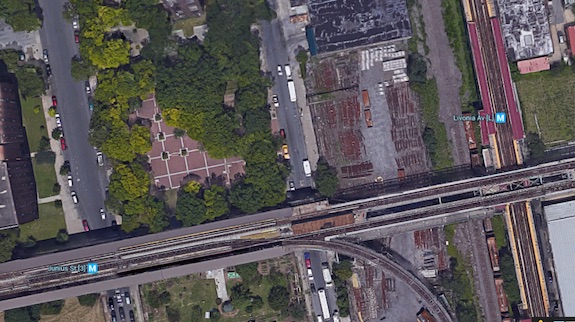
The R, in other words, is the perfect storm of problems for the MTA. It runs through rapidly expanding (and gentrifying) neighborhoods and offers Bay Ridge its lone, slow subway connection to Manhattan. The pure data is hard to pinpoint, but experiences and anecdotes suggest the service along this line has not been up to snuff lately. As the R stretches from Forest Hills to Bay Ridge and shares tracks at various points with the N, Q, and M lines, the challenges are extreme.
In writing to the MTA last month, Gentile offered up a laundry list of solutions. His letter said:
First, if nothing else, conduct an audit to find out just how bad the service is and exactly what is needed to alleviate the trouble. Second, add more and newer trains to the R route to increase frequency and decrease late arrivals of the R. Third, put the R train on its own line in Manhattan so that delays caused by waiting for other trains that run on the same line, such as the N, cease to happen. Fourth, speed up the installation of platform countdown clocks and add other amenities on the subway cars such as digital stop trackers. Finally, if you do not replace the train cars entirely, at the very least add new audio systems that riders can actually hear and decipher in the event of an emergency or delay. Currently, a majority of the audio systems on the R train fleet are inaudible and/or incomprehensible.
In addition, I am proposing several changes to the scheduling for the R line that I also request be made as soon as possible. First, discontinue the late night R shuttle that forces riders heading into Bay Ridge at night to get off the train at 36th Street in Sunset Park and wait upwards of an additional 20-30 minutes for an R shuttle to arrive and complete their trip home. Second, since the TA itself claims many delays on the R line result from the length of the entire line itself, I am advocating the creation of an R line rush hour special from 95th Street in Bay Ridge to Chambers Street and back. This special segmented line will address and alleviate some of the delays experienced by Bay Ridgeites who work in lower Manhattan.
This is a jumble of ideas, again some better than others, but it seems indicative of the need for additional peak-hour service along 4th Ave. In addition to the letter, Gentile, along with Daniel Squadron, the Straphangers Campaign, and the Riders Alliance, has urged the MTA to conduct a full line review — essentially an audit — of R train operations to determine how best to improve the line. These line reviews can be modest and may fall victim to politics, but auditing service along particular lines is something the MTA has said it will do regularly.
Yet, the MTA is a bit resistant to the idea that the R is problematic. Internal load guidelines — also established by the MTA and loosened in 2010 — have determined the R to be at 62 percent of capacity during a.m. peak hours and between 30-60 percent of capacity during non-peak hours. This has always raised questions regarding induced demand and chicken-and-egg problems. Can the MTA improve service and boost ridership by increasing service and improving reliability?
In response to the request for an audit, though, the MTA told R train riders they will have to wait a bit longer for improvements. Here’s the agency’s statement:
Chairman Prendergast has committed to undertake full line reviews of all subway lines in the system. Since 2009, NYCT has completed reviews of the F, L, G and recently the A and C lines. Since all of the reviews conducted thus far have focused on the subway’s lettered lines (like the R), NYCT plans to select one or more lines on the numbered lines as the next line(s) to review. A review of the R has not yet been scheduled because if we were to conduct a line review of the R now, it would be obsolete almost immediately, because the opening of the Second Avenue Subway will significantly change overall service on the Broadway Line. The opening of Second Avenue Subway will affect how many people ride the R and how the R operates, so it would be premature for us to conduct an R line review on the cusp of such a change.
So the R could be doing better, but it’s not at capacity. Meanwhile, we’re on the cusp of major changes to the BMT once the Second Ave. Subway opens (whenever that might be), and for now, R train riders are stuck with what they have, an M-less ride down 4th Ave. Is that a satisfactory response? It’s hard to say.