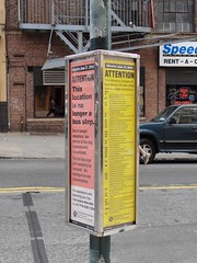
While the new routes are in effect, many stations still feature old maps.
New York City Transit has a map problem. It’s not that the new subway map is bad. In fact, the redesign with fewer bus boxes and less unnecessary information makes the map more useful as a system navigation tool. The devil, however, is in the stations as five days after the service changes went into effect, the maps present throughout the system are still in the process of being updated.
To illustrate, a story: Every morning, I ride the train from Grand Army Plaza to Brooklyn Bridge-City Hall. I exit the stop in Manhattan at the northern end and pass through the unstaffed entrance that leads into Foley Square. The subway maps at both stations have been updated, but every other piece of supporting navigational materials has not. The “Neighorhood” maps at both Grand Army Plaza and City Hall still show the brown M train and its route into Brooklyn via the Montague St. tunnel. The Manhattan bus map at City Hall displays the routes as of last week and not this past Monday.
These aren’t isolated incidents. I’ve ridden more than a few trains that still display the old maps, and today, my Brooklyn-bound 2 train announced that customers could transfer to the J and M trains at Fulton St. The M hasn’t stopped there since last Friday. The Fulton St. complex is the tenth busiest station in the system, and if Transit’s pre-recorded announcements are telling people wrong information, that’s a problem.
Meanwhile, at other stations, the situation remains the same. Last night, I made the trip from Chambers St. to Christopher St. The latter is a reasonably popular destination stop. In 2009, an average of 10,000 people passed through it every weekday, and it serves as the gateway to Greenwich Village for many tourists visiting the city. The former serves around 20,000 per day. In both of those stations, featured prominently at the Customer Information Center, were subway maps that hadn’t yet been updated to reflect the new routing. Now, I’m not talking about far-off stations in the Rockaways that see a few hundred people a day; I’m talking about the 65th and 128th busiest stations in the system.
Eventually, Transit workers will get around to fixing these problems. The new maps will go up; life will go on. Yet, this situation reminds me of the post I wrote earlier this week about the MTA’s customer service woes. For weeks, Transit has been planning for the new service cuts and rerouted subway lines. The authority made a big show of putting up new subway bullets and fixed an obscene meme in two days when the Internet uproar began. Yet, five days after the cuts, they still haven’t replaced the maps hanging in at least a few stations, and the Neighborhood and Bus maps might remain outdated for some time.
This delay in updating the maps — arguably as important as hanging up some subway bullets at oft-deserted ends of platforms — isn’t a grave oversight by the MTA. It just shows how the authority doesn’t consider its customers. If anything, the maps should be the first things in a station changed because they are what allows people unfamiliar with the system to get around. A tourist unfamiliar with the subway system and bound for, say, MoMA would be left waiting for a V train that won’t arrive and would find at Christopher St. no station agent able to provide them with directions. The customer, it seems, is an afterthought.

 Twenty ten has been very unkind for the MTA. The year started out with Albany robbing the authority of over $143 million, and it’s been one bad piece of economic news after another. The payroll tax has fallen around $300 million short of expectations. The MTA has to go through the charade of public hearings to cut station agents. Now, Albany
 On December 17, 2001, the V train made its
  Updated (11:45 a.m.): Nearly six years ago, the MTA changed its service patterns and didn’t tell anyone. In 2004, when the Manhattan Bridge reopened, service patterns along the B, D, Q and N trains changed in parts of three boroughs, and riders ignored the warnings.

