Second Ave. Sagas
  • About
  • Contact Me
  • 2nd Ave. Subway History
  • Search
  • About
  • Contact Me
  • 2nd Ave. Subway History
  • Search
Second Ave. Sagas

News and Views on New York City Transportation

MTA Technology

A rant on using PA/CIS as a communications tool

by Benjamin Kabak September 21, 2011
written by Benjamin Kabak on September 21, 2011

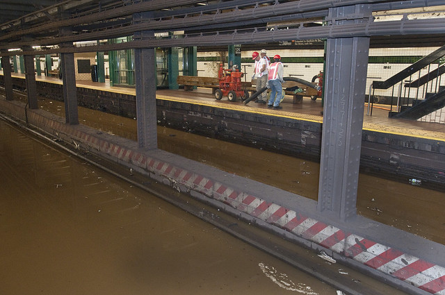
Suspicious activity is about the only creative announcement the PA CIS system is capable of broadcasting. (Photo by Benjamin Kabak)

For the past few years, I have been an unabashed supporter of the MTA’s new countdown clocks. The system, available in most A Division stations, is based on a signalling system that can assess where along the signal blocks and also how far away the next train is. Ostensibly, the system is flexible as well as the CIS part of PA/CIS allows the MTA to provide customer information to certain stations from a centralized location. Unfortunately, it doesn’t seem to work like that.

Last night, I had one of those moments that I often have at Nevins St. when something goes wrong with the subway system that could have easily been avoided. It’s happened often and usually it involves headways that are improperly spaced or an announcement that should have been made. Last night, it was the latter.

This story begins as my tales from Nevins St. often do: on a 4 train on the way back from Yankee Stadium. It was around 11:30 when we pulled into Nevins, and the PA/CIS clocks said the next local train was eight minutes away. Usually, I would just walk home from Atlantic in the face of an eight-minute wait, but I was tired and had a good book with me. So I waited.

As I waited out those eight minutes for the 3 train (with a 2 train just two minutes behind), another 4 came and went at Nevins St., and no signs of a problem emerged. The 3 arrived on time and inched its way to Atlantic Ave. I noticed something was wrong when it hit the switch and wound up on the express tracks. Only then did the conductor announce that all trains were running express from Atlantic Ave. to Franklin Ave. due to track work.

Now, this was not an unplanned service change. Had I read the service alerts before leaving or had I walked to the other end of the Nevins St. platform to inspect the one sign hanging there, I would have seen it. But I didn’t. Instead, I waited. I waited as the automated PA/CIS announcements alerted me to approaching trains. I waited in sight of a countdown clock that not once warned passengers of a service change. I waited near a column that had no hanging signs. In fact, only until I walked past Bergen Street — a station closed because of the service change — did I see a sign warning of the 11 p.m. start time.

Over the years, I’ve written about the MTA’s need to focus on its customer. The authority has taken great strides in the realm of technology, but it hasn’t yet bridged the gap between active and passive information. The conductor on my original 4 train should have warned riders that there would be no local service between Atlantic and Franklin Aves. The conductor on the next 4 train should have said the same thing, and the MTA, which has the ability to do so, should have programmed the PA/CIS monitor to announce the change. For nearly ten minutes, I waited in Nevins St. with no visible or audible sign of an impending service change.

Ultimately, last night, I learned a lesson I should have learned a long time ago. Even if there are no individual signs, it’s best to check the service advisories at any time of day. Still, the MTA should learn a lesson too from the numerous irate customers who found out about the change after standing around Nevins St. for ten minutes: Information is key. With new technologies, Transit can better alert its riders to service changes, and they can take an active role in doing so. That is, after all, why the new devices are called Public Address/Customer Information Signs. It’s in the name.

September 21, 2011 18 comments
0 FacebookTwitterPinterestEmail
BusesPublic Transit Policy

From LI Bus, a case study in the purpose of transit

by Benjamin Kabak September 21, 2011
written by Benjamin Kabak on September 21, 2011

Here’s an interesting question for you: Should public transit systems and the public authorities that run them be trying to turn a profit? In other words, at what point should authority heads such as Jay Walder cease running a transportation network as a public good and start running it as a business?

The answer to this question isn’t an easy one in an age of austerity. By and large, public transportation networks are inherently not operated as a business as the service level. In New York, for instance, the MTA runs mostly empty trains at 3 a.m. and allows buses to run routes with a cost-per-passenger high enough to make any private CFO cry. That’s how New York City exists as a huge economic hub and tourist destination today, and that’s how mass transit is operated as a public good.

On the other hand, though, are a few competing demands. First, the MTA must operate these services efficiently through a streamlined bureaucracy and a procurement process that isn’t beset with red tape. Second, it cannot become an organization beholden to pension costs and lifetime benefits. Third, it will require public subsidies from a government whose constituents depend on public transit for their daily lives, and politicians will have to recognize that the MTA or a similarly situated organization may not operate as efficiently as a corporation that answers to stock-holders. The demands are different, and the expected benefits are different.

Recently, a few good minds in the transit realm have been debating the way transit authorities operate. David Levinson has called for financially sustainable mass transit systems while Jarrett Walker has called upon those funding transit systems to better outline their goals. The competing demands of ridership vs. coverage are at odds with financially self-sustaining transit systems. I’ve simplified their arguments, and it’s worth reading their pieces at length because we’re seeing this debate play itself out in real life on Long Island.

The Long Island Bus saga has been a debacle. In its original agreement with Nassau County, the MTA agreed to operate the service as long as the county paid for it. Over the years, the county’s contributions had decreased while the MTA’s had increased, and the authority threatened to pull out of Nassau if County Executive Edward Mangano didn’t agree to upping the county’s contributions from $9 million to $26 million. Mangano called the MTA’s bluff and decided he could run the bus system for less by farming it out to a private company. He claimed no service cuts or fare hikes would follow.

From the start, the privatization process has been a mess. The county used a non-transparent process to pick Veolia, a company with close ties to Mangano’s campaign, and they failed to meet a July deadline for an agreement. The MTA will operate the buses until December 31, and at that point, Nassau County will reduce its contributions to just $2.5 million — $6 million less than the cost of fuel alone. Veolia will then be expected to cover the difference. Without subsidies, no one, including the company’s CEO, knows how.

Earlier this week, Michael Setzer spoke about how the company would save the millions it stands to lose from the MTA and state when it takes over the LI Bus network. “You can’t save $35 million by turning off the lights,” Setzer said. In other words, there’s virtually no way Veolia can operate the bus system with its current route structure and fare system while breaking even or turning a profit.

On their website, if you read closely enough, Veolia has said as much. They are threatening “adjustments” of bus timetables that will reduce frequency, and while they say there is no plan in place to raise fares next year, they also say that “it’s possible that modest service redesigns and fare increases will be recommended.” You can’t just save $35 million by turning off the lights.

Veolia is a private company long used to operate bus systems with large public subsidies. If they can’t turn a profit in Nassau County with a meager subsidy and the current route plan or fare structure, something will have to go. Relatively empty buses that provide a transit lifeline for people who can’t afford anything else will be cut, and fares will go up. A public good won’t be so public any longer.

As this grand experiment rushes toward a launch, we’ll watch Nassau County closely. It could be a model for how transit agencies can operate, but it sounds as though it’s going to be an example in government failure and the decline of a once-proud bus system. Perhaps Nassau County will come to its senses and recognize the purpose of its bus system before it’s too late, but I’m not counting on it.

September 21, 2011 19 comments
0 FacebookTwitterPinterestEmail
Public Transit Policy

A digression on parking rates and spaces

by Benjamin Kabak September 20, 2011
written by Benjamin Kabak on September 20, 2011

Over the years here, as I’ve tried to develop a semi-coherent argument for public transit investment at the expense of automobiles, I’ve occasionally returned to the idea of the parking space. Two years ago, I said the city could fund transit by raising on-street parking rates, and I’ve argued in favor of residential parking permits as a way to raise revenue for anything from street repair and maintenance to public transit investments.

My biggest complaints about parking spaces concern the way we use space and the way we charge for it. In New York, everything costs a lot. Housing prices are high; office rates are high; parkland is at a premium; even sidewalk space has whittled down over the years. Yet, cars get away with parking for free. In essence, you have around two tons of inert metal taking up precious urban space and paying nothing for in exchange for the privilege.

In his City Room column today, Clyde Haberman plays off of the deactivation of the last Manhattan parking meter to wax poetic on parking spaces. Much like the death of the token brought about thought-provoking reflections on mass transit, so too has the death of the parking meter. Muni-meters, after all, free up space. No longer are cars bound by parking meters, and that can be both good and bad for on-street parking.

Haberman’s point, though, is a different one. “Why,” he asks, “is public space, a most precious commodity in this city, allowed to be used as a private storage area?” He continues:

Years ago, I asked in a column if it would be all right for a New Yorker in a crowded apartment to put a chest of drawers on wheels and leave it at curbside — observing all parking rules and taking a chance on theft. The very idea was, of course, absurd; you can’t store personal property on the street.

Why, then, is it O.K. to do that when the wheeled property is called a car?

If public space is to be used for this private purpose, perhaps what the city needs to do is greatly expand the areas where people must pay for the privilege.

Not that this could be done without fierce resistance from some on the City Council and in the State Legislature. Generally speaking, when it comes to the proper place of the automobile in this crowded city, what we have, as Cool Hand Luke found out in his own way, is a failure to communicate.

I don’t believe cars are inherently evil. My family has lived in New York City for my entire life, and we’ve always owned a car. I’m enrolled with the AAA and and card-carrying member of ZipCar. I’m also sympathetic to those who say that fees and taxes in New York are getting out of hand. Parking, though, is a market-based solution. If the market is willing to support significantly higher parking rates, why does New York continue to squander a money-making resource while it gives premium space away for free?

September 20, 2011 35 comments
0 FacebookTwitterPinterestEmail
MTA Technology

‘On The Go’ pilot brings travel info underground

by Benjamin Kabak September 20, 2011
written by Benjamin Kabak on September 20, 2011

Paul Fleuranges offers up a demonstration of the MTA's new On The Go video board. Photo courtesy of New York City Transit.

Over the past few years, the MTA has moved its technological offerings into the 21st century. The authority took a staid website with little interactivity, and bit by bit, they have added more real-time information about subway and rail services, introduced a better TripPlanner and unveiled a map that will change as the weekend service does. With bus trackers and countdown clocks going live, customers should be better informed than ever before.

Still, though, the MTA has to get its information through a physical barrier. As a large portion of the subway system is underground, cell signals do not penetrate to the stations below, and at the times when customers most need that real-time information, they have no way of accessing it. Enter the new “On The Go” program.

The new travel stations, unveiled yesterday at Bowling Green by MTA officials, is part of a pilot program that will include five subway stations and commuter rail hubs. Interactive touch screens will be set up Bowling Green, Grand Central, Atlantic Ave./Pacific St., Jackson Heights/Roosevelt Avenue and Penn Station. The interactive data offerings include maps, TripPlanner capabilities, real-time status updates, escalator and elevator outages and local neighborhood maps. The MTA will also partner with third-party app developers to provide additional local information and, for example, dining guides from Zagats. Similar to those in taxicabs, the screens will also show a news crawl and the latest weather.

“With On the Go, we are adding yet another layer of state-of-the-art customer communications into our subway system, but it goes far beyond the already helpful information provided by our countdown clocks and the displays in our new technology subway cars,” Transit President Thomas F. Prendergast said. “On the Go will provide riders with instant information that makes using the transit system more efficient.”

The technology behind these terminals comes from Cisco’s Interactive Services Solution. A general manager from the company spoke about the way the screens can both improve passenger experience while creating new revenue sources for the MTA. “We have worked with cities all over the world, as a part of our Smart+Connected Communities initiative, in using the network as the platform to transform physical communities to connected communities. This pilot demonstration shows the potential for technology to connect, enhance and improve the quality of life for communities,” Syed Hoda said.

Following the unveiling yesterday, a few commentators wondered about the durability of such devices, but Transit says they are built to withstand the beating to which New Yorkers will subject them. Antenna Design New York Inc., the same firm behind the Help Point pilot program, has constructed a stainless steel enclosure with components that are durable and easy to clean and maintain. Of course, based on the MTA’s touchy relationship with technology, that’s one area in which the authority will have to prove itself through actions rather than words.

Ultimately, if customers are accepted of the new technology, the MTA anticipates installing these devices throughout the system. Officials believe the screens can also generate revenue through advertising which would “help to defray the costs of installation.”

September 20, 2011 7 comments
0 FacebookTwitterPinterestEmail
Abandoned Stations

A plan for a park underneath Delancey Street

by Benjamin Kabak September 20, 2011
written by Benjamin Kabak on September 20, 2011

Renderings of the Delancey Underground pay homage to the Underbelly Project. Photo via Inhabitat.

Over the past year, since the Underbelly Project exposed New York City to the abandoned South 4th Street subway station, interest in the various unused parts of the subway infrastructure has been on the rise. It’s part of a cycle really. Over the years, various groups have called upon the MTA to reopen the City Hall stop, provide tours for shuttered stations and flat-out admit that some stations exist. After all, many at the MTA won’t admit that the South 4th Street shell exists, let alone that a street art project used it as a canvas.

Since Underbelly, though, the MTA’s relationship with its unused infrastructure has grown more strained. Transit sometime last fall sealed up one of the South 4th Street access points with a new false wall in an effort to keep vandals and urban explorers out. By doing so, though, they also allow a part of subway history when the city dared to dream big to fade away behind new walls. Not everything has been ignored though.

Across the tracks from the BMT’s Essex St. subway station rests the unused trolley terminal that, until 1948, brought riders across the Williamsburg Bridge. These days, the old station sits unused and in disarray, a visible relic of another error, but some architects and social innovators want to turn into an underground park. Eying the success of the High Line, they want to turn the trolley terminal into the Low Line. By channeling sunlight into the subterranean cavern via fiber optics network, they could print light and plant life to what is now a dank, dark space.

On Monday, James Ramsey, an architect and engineer from RAAD Studio, along with Dan Barasch of PopTech and R. Boykin Curry IV of a New York investment firm, unveiled the Delancey Underground website as part of a publicity push for their idea. They were featured in New York magazine and spoke at length with The Low Down NY about their idea.

Ramsey, who went on a tour with some MTA officials last year, talked about the concepts behind the Low Line. “We were thinking about this amazing space lurking underneath Delancey Street, totally in the darkness, dripping, just sitting there, not activated,” he said. “We started thinking, how can we activate this space, how can we make something appealing here? A very natural way to do that is to introduce natural sunlight. What happens if you (do that) is that you can actually grow some plants down there. It’s a totally bizarre fun idea but I think it makes a lot of natural sense.”

The trolley terminal at Delancey Street has sat unused since the late 1940s. Photo via Inhabitat.

A brief bit published by Inhabitat discusses some of the technology behind it as well:

Even though the park design will be set below the street, the goal is to create a space that is far from a dark, dank and depressing destination. The ground-breaking design team is banking on a high-tech fiber optic lighting system to enable a green space that is bright, sunny and welcoming. The park will be equipped with extensive lighting units utilizing fiber optics to channel natural daylight to the depths below. Dozens of lamppost-like solar collectors will be placed on the Delancey Street to complete this task. And as a bonus, the system the designers envision will also filter out harmful ultraviolet and infrared light, but keeping the wavelengths used in photosynthesis to foster and nourish plant growth.

The idea itself seems like a neat one on the surface. It rivals one out of Boston in terms of creativity and outside-the-box thinking, but the practical considerations make it a long shot. In conversations with transportation officials with knowledge of the situation, I understand that the team has a in with the current MTA leadership, but that leadership is on the way out in a few weeks. Hence, the recent effort to drum up public support. They’ve presented to city officials and will soon be meeting with Community Board 3 who would have to approve numerous aspects of this plan.

As far as the space is considered, the politics are a little more delicate. The MTA currently controls the unused trolley terminal, and they’re not going to simply hand it over to the Parks Department without adequate compensation or safety assurances. Furthermore, the authority rightly won’t contribute a dollar to this program, and anyone who replaces Jay Walder likely won’t view this project as a priority. Finally, it’s likely that the MTA or similarly situated government entity would have to open up this space to an RFP process and bidding before it could move ahead.

It took the High Line supporters ten years to realize their goals of a park atop that rail line. Patience, it seems, is a virtue for proponents of creative uses for public space. Maybe the Low Line — bad name and all — isn’t a perfect idea; maybe it won’t see the light of day. But it will make people think, and if the city can turn an abandoned trolley terminal into something useful, the early ideas will have been well worth it.

The Low Line park would bring light underground. Image via Inhabitat.

September 20, 2011 26 comments
0 FacebookTwitterPinterestEmail
Service Advisories

CPW water main break impacting IND service

by Benjamin Kabak September 19, 2011
written by Benjamin Kabak on September 19, 2011

A glimpse at water levels at 125th Street earlier this afternoon (Photo via Metropolitan Transportation Authority, Patrick Cashin)

Due to a water main break near 110th Street and Central Park West, New York City Transit is anticipating severe service disruptions for the A, B, C and D trains this evening. As of around 3:50 p.m., B and C trains are suspended from end to end, and A train service is suspended between West 145th Street and 59th Street-Columbus Circle. The D is not operating between 161st Street-Yankee Stadium and 34th Street-Herald Square.

Transit says it will be providing shuttle train service on the Concourse (D) Line between 205th Street and Yankee Stadium in order to allow customers to transfer to the 4. A similar shuttle train will from 207th Street to 168th Street to allow for a connection with the 1, and subway-bound straphangers leaving Yankee Stadium have been told to take the 4 train. Metro-North will cross-honor tickets from Yankee Stadium to Harlem-125th Street and Grand Central.

According to a report from DNA Info, the main that broke is a 30-inch tube that’s approximately 100 years old. MTA crews are currently pumping out water that’s covering tracks at stations from 103rd to 125th Streets along Central Park West and St. Nicholas Ave. Although four pumps are working to remove 6000 gallons of water per minute, Transit does not yet know when regular service along these IND routes will be restored. Get ready for a fun commute home tonight.

Water from a ruptured main near Central Park West and 110th Streets floods the avenue. (Photo via DNA Info)

September 19, 2011 7 comments
0 FacebookTwitterPinterestEmail
Metro-North

Photo of the Day: Bike hooks for the M-8s

by Benjamin Kabak September 19, 2011
written by Benjamin Kabak on September 19, 2011

Cyclists at Grand Central Terminal on Friday tested prototype bicycle hooks being piloted on Metro-North's M-8 cars by the Connecticut Department of Transportation. Photo by Metropolitan Transportation Authority, Patrick Cashin.

For a long time, bicyclists and Metro-North trains have co-existed rather uneasily. The MTA charges a $5 permit for those who wish to bring their bikes on board, but the limitations are extensive. Bikes are, of course, not allowed at all in peak directions during peak hours, and the railroad limits the total number of bicycles per train to four during the week and just eight during the weekend. For cyclists who want to take advantage of the numerous trails around the New York area, these rules make riding the rails onerous and sometimes impractical.

On and off, we’ve heard of efforts by the MTA to improve the way bikes are stored on Metro-North trains. The authority originally announced a prototype test on the M-7s back in 2009 but had to cancel amidst cost concerns last year. Now, the prototype is back on track.

Last Friday, Metro-North held a demonstration of a potential bike solution for the M-8 trains. They tested two types of hooks as cyclists experimented with the hanging bike hooks. I’ve heard that test trains will run on the New Haven line between now and November 13, and NYCC has published the prototype schedule. Bikes can be just as intrusive as those travelers with giant luggage who often use Metro-North, and adding hooks as an accommodation should help make it easier for those on two wheels to get around.

September 19, 2011 7 comments
0 FacebookTwitterPinterestEmail
Congestion FeeMTA Politics

The return of the son of the return of congestion pricing

by Benjamin Kabak September 19, 2011
written by Benjamin Kabak on September 19, 2011

For many transportation advocates in the New York City area, congestion pricing is that idea that just won’t go away. When the city launched a failed bid for such a pricing scheme three years ago, a slim majority of New Yorkers supported such a plan — and even more did so when revenues were guaranteed to be invested in public transit — but the plan died a political death. Since then, it has hovered on the periphery of politics, not quite receding but never coming back.

Today, the Daily News checks in on the status of the congestion pricing fight and finds that things are in a holding pattern. The same small group of people who haven’t yet gained the backing of big-name, powerful New York State politicos are still out there fighting the good fight, and although they think the tide might turn, it clearly hasn’t yet.

Still, the numbers being thrown around are significant. MOVE NY, a group headed by Alex Matthiessen, a member of the 2008 Commission on Sustainability and the MTA created in 2008 by Elliot Sander and long-time supporter of Charles Koumanoff’s balanced transportation analyzer, says the right congestion pricing plan could realize $1 billion in annual revenues. Furthermore, the plan has something for transit riders too: With congestion pricing revenues, the MTA could lessen and delay planned fare hikes. Kenneth Lovett has more:

Under the “MOVE NY draft sustainable mobility plan,” drivers entering New York City’s central business district, from 60th St. down to the Battery, would pay a toll at 22 entry points. The tolls would vary based on the time of day. Peak hours – between 6 a.m. and 6 p.m. – would be in the same range as the Port Authority’s bridge and tunnel tolls, and the cost would be lower overnight and on weekends.

Yellow cabs would not be subject to the tolls, but they would be slapped with a $1-per-trip increase to generate $180 million a year, with $20 million going toward the hacks’ health care. Livery cabs would get a 50% discount, and commercial vehicles would not pay more than once a day. The plan would also chop tolls by 15% for the Whitestone, Throgs Neck, Cross Bay and Verrazano bridges, and defer by a year a 2013 MTA fare and toll hike…

“Everyone we’ve spoken to across the region agrees that we need to find new funding for our transportation system and appreciates the effort we’ve made to test different ideas and solicit feedback,” said Alex Matthiessen, an environmental consultant and MOVE NY campaign director.

I haven’t had a chance to review the draft of the sustainable mobility plan, but all of these tweaks and changes to the basic pricing plan seem like the give and take of politics. The plan still needs a champion in New York City and one in Albany who is willing to put themselves out there and can round up the support needed to move this through the legislature. I still think a trade-off could be achieved by reducing the payroll tax in exchange for congestion pricing, but so far, no anti-payroll tax politicians have been willing to take that stance.

There is one final cause of concern as well. The last word in Lovett’s article belongs to an anonymous source from Albany. “I think there is zero appetite,” a lawmaker said. “They can dress this up all they want, but people just don’t trust the MTA.” A quick read through the Daily News comments reveals that mistrust. New Yorkers and lawmakers alike simply don’t trust the MTA.

Now, the MTA and Albany have been through this game before. The MTA threatens service cuts and fare hikes while Albany claims the MTA is mismanaged and can’t spend its money properly. Usually Albany is willing to step in, but for the past few times, the MTA has called their bluff. We’ve had steep fare hikes and serious service cuts. Still, state lawmakers claim they don’t trust the MTA, and these statements to the press feed public mistrust as well. It’s a cycle that is going to end either with change in Albany or serious cuts in public transit service. It’s time to bridge that gap, and it’s getting closer to a time when a congestion pricing plan deserves to be a part of a serious public conversation.

September 19, 2011 22 comments
0 FacebookTwitterPinterestEmail
Service Advisories

Weekend work impacting travel everywhere

by Benjamin Kabak September 17, 2011
written by Benjamin Kabak on September 17, 2011

Apologies for the delay in publishing these changes this weekend. I was out of town last night without an Internet connection. For those of you who don’t yet like the MTA’s new Weekender offering, there’s always Subway Weekender with the more traditional map. As always, these come to via NYC Transit and are subject to change without notice.


From 12:01 a.m. Saturday, September 17 to 5 a.m. Monday, September 19, Flatbush-bound 2 trains skip Bergen Street, Grand Army Plaza and Eastern Parkway due to conduit installation (for new fiber optic cable) between Nostrand Avenue and Sutter Avenue-Rutland Road.


From 6:30 a.m. to midnight, Saturday, September 17 and Sunday, September 18, New Lots-bound 3 trains skip Bergen Street, Grand Army Plaza and Eastern Parkway due to conduit installation (for new fiber optic cable) between Nostrand Avenue and Sutter Avenue-Rutland Road.

(Overnight)
From 12:01 a.m. to 6:30 a.m. Saturday, September 17 and Sunday, September 18, and from 12:01 a.m. to 5 a.m. Monday, September 19, New Lots-bound 4 trains skip Bergen Street, Grand Army Plaza, Eastern Parkway, Nostrand Avenue and Kingston Avenue due to conduit installation (for new fiber optic cable) between Nostrand Avenue and Sutter Avenue-Rutland Road.


From 6 a.m. to 8 p.m., Saturday, September 17 and Sunday, September 18, Flushing-bound 7 trains skip 33rd, 40th, 46th 52nd and 69th Streets due to the installation of cable trays and brackets.


From 12:01 a.m. Saturday, September 17 to 5 a.m. Monday, September 19, shuttle trains and buses replace A train service between Howard Beach and Far Rockaway due to the rebuilding of existing piers and bearings on the South Channel Bridge and the replacement of drain pipes at the South Channel Bridge and Hammel’s Wye. Rockaway Park shuttle trains operate between Far Rockaway and Rockaway Park. Free shuttle buses operate between:

  • Howard Beach and Far Rockaway (non-stop)
  • Howard Beach and Rockaway Park, making one stop at Broad Channel


From 7 a.m. to 5 p.m., Saturday, September 17, there is no A or C train service at Fulton Street in either direction due to work at the Fulton Street Transit Center.


From 6:30 a.m. to midnight, Saturday, September 17 and Sunday, September 18, there are no C trains between Manhattan and Brooklyn due to the Culver Viaduct Rehabilitation. C trains are rerouted on the F line between West 4th Street and 2nd Avenue (last stop). Customers for Spring, Canal and Chambers Streets should take the A or E. Customers for Brooklyn, take the A or F. Note: F trains operate on the C line between Jay Street-MetroTech and Euclid Avenue.


From 12:01 a.m. Saturday, September 17 to 5 a.m. Monday, September 19, Manhattan-bound D trains run on the N line from Coney Island-Stillwell Avenue to 36th Street (Brooklyn) due to structural repair and station rehabilitation from 71st Street to Bay 50th Street and ADA work at Bay Parkway. Note: At all times until Friday, October 28, the southbound D is bypassing 71st Street due to stair reconstruction. So, there is no D service at 71st Street this weekend.


From 12:01 a.m. Saturday, September 17 to 5 a.m. Monday, September 19, Coney Island-bound D trains run local from DeKalb Avenue to 36th Street (Brooklyn) and Manhattan-bound D trains run local from 59th Street (on the N line) to DeKalb Avenue due to work on the Culver Viaduct. Note: The D stops at DeKalb Avenue in both directions this weekend.

(Overnight)
From 12:01 a.m. to 6:30 a.m. Sunday, September 18, Jamaica Center-bound E trains skip Van Wyck Blvd. due to cable work north of Kew Gardens-Union Turnpike.


From 12:01 a.m. Saturday, September 17 to 5 a.m. Monday, September 19, free shuttle buses replace F service between Jay Street-MetroTech and 18th Avenue due to work on the Culver Viaduct including: installation of new signals, signal boxes, cable, insulated joints and rail between Bergen Street and 4th Avenue-9th Street. F trains operate in two sections:

  • Between 179th Street and Jay Street-MetroTech, and then are rerouted to the C to Euclid Avenue
  • Between 18th Avenue and Coney Island-Stillwell Avenue

Free shuttle buses operate in three sections:

  • Between Jay Street-MetroTech and 18th Avenue (Limited) making stops at Church Avenue and Ditmas Avenue only.
  • Between Jay Street-MetroTech and 4th Avenue-9th Street, making stops at Bergen Street, Carroll Street and Smith-9th Streets only.
  • Between 4th Avenue-9th Street and Church Avenue, making stops at 7th Avenue, 15th Street-Prospect Park and Ft. Hamilton Parkway only.

Manhattan-bound customers should consider transferring to the R at 4th Avenue-9th Street.


From 12:01 a.m. to 12 noon, Sunday, September 18 Queens-bound F trains skip Van Wyck Blvd. and Sutphin Blvd. due to cable work north of Kew Gardens-Union Turnpike.


From 12:01 a.m. Saturday, September 17 to 5 a.m. Monday, September 19, there is no G train service between Hoyt-Schermerhorn Sts. and Church Avenue due to work on the Culver Viaduct including: installation of new signals, signal boxes, cable, insulated joints and rail between Bergen Street and 4th Avenue-9th Street. Customers should take the A or F from Hoyt-Schermerhorn to Jay Street-MetroTech for shuttle bus to Church Avenue. See F entry for shuttle bus information.


From 12:01 a.m. Saturday, September 17 to 5 a.m. Monday, September 19, there are no L trains between 8th Avenue and Broadway Junction due to CBTC track and signal work between Bedford Avenue and 3rd Avenue. The M train, M14 and free shuttle buses provide alternate service. M train service is extended to 57th Street-6th Avenue. The M14 bus replaces L service between 1st and 8th Avenues. Free shuttle buses operate:

  • Between Broadway Junction and Myrtle-Wyckoff Avs.
  • Between Myrtle-Wyckoff Avs and Lorimer Street-Metropolitan Ave G station
  • Between Lorimer Street-Metropolitan Ave G station and the Marcy Avenue J, M station

Note: Manhattan-bound customers should transfer to the A, F or J train at Broadway Junction or the M at Myrtle-Wyckoff Avs.


From 6 a.m. to midnight, Saturday, September 17 and from 8 a.m. to 11 p.m. Sunday, September 18, M service is extended to 57th Street-6th Avenue F station due to CBTC track and signal work between Bedford Avenue and 3rd Avenue on the L line.


From 4 a.m. Saturday, September 17 to 10 p.m. Sunday, September 18, southbound N trains run express from Astoria Boulevard to Queensboro Plaza, skipping 30th Avenue, Broadway, 36th Avenue and 39th Avenue due to track panel installation between Astoria Boulevard and 36th Avenue.


From 10 p.m. Friday, September 16 to 5 a.m. Monday, September 19, uptown N trains skip Prince, 8th, 23rd, and 28th Streets due to platform edge rehabilitation at 34th Street.


From 6:30 a.m. to midnight, Saturday, September 17 and Sunday, September 18, uptown R trains skip Prince, 8th, 23rd, and 28th Streets due to platform edge rehabilitation at 34th Street.

(Rockaway Shuttle)
From 12:01 a.m. Saturday, September 17 to 5 a.m. Monday, September 19, there are no S (Shuttle) trains between Broad Channel and Beach 90th Street due to the rebuilding of existing piers and bearings and the replacement of drain pipes on the South Channel Bridge. Shuttle trains operate between Rockaway Park and Far Rockaway. Free shuttle buses operate between Rockaway Park and Broad Channel. (See A entry for shuttle bus information.)

September 17, 2011 11 comments
0 FacebookTwitterPinterestEmail
AsidesService AdvisoriesSubway Maps

Give the MTA’s new Weekender map a whirl

by Benjamin Kabak September 16, 2011
written by Benjamin Kabak on September 16, 2011

I’m away from my computer right now so I can’t give the MTA’s new online weekend map a ride, but you can. Check it out right here in all of it’s Vignelli glory. As you poke around with the map, I would love to hear your reactions. Leave a comment with your thoughts, criticisms and potential improvements, and we’ll soon find out just how useful this new offering is.

September 16, 2011 28 comments
0 FacebookTwitterPinterestEmail
Load More Posts

About The Author

Name: Benjamin Kabak
E-mail: Contact Me

Become a Patron!
Follow @2AvSagas

Upcoming Events
TBD

RSS? Yes, Please: SAS' RSS Feed
SAS In Your Inbox: Subscribe to SAS by E-mail

Instagram


Disclaimer: Subway Map © Metropolitan Transportation Authority. Used with permission. MTA is not associated with nor does it endorse this website or its content.

Categories

  • 14th Street Busway (1)
  • 7 Line Extension (118)
  • Abandoned Stations (31)
  • ARC Tunnel (52)
  • Arts for Transit (19)
  • Asides (1,244)
  • Bronx (13)
  • Brooklyn (126)
  • Brooklyn-Queens Connector (13)
  • Buses (291)
  • Capital Program 2010-2014 (27)
  • Capital Program 2015-2019 (56)
  • Capital Program 2020-2024 (3)
  • Congestion Fee (71)
  • East Side Access Project (37)
  • F Express Plan (22)
  • Fare Hikes (173)
  • Fulton Street (57)
  • Gateway Tunnel (29)
  • High-Speed Rail (9)
  • Hudson Yards (18)
  • Interborough Express (1)
  • International Subways (26)
  • L Train Shutdown (20)
  • LIRR (65)
  • Manhattan (73)
  • Metro-North (99)
  • MetroCard (124)
  • Moynihan Station (16)
  • MTA (98)
  • MTA Absurdity (233)
  • MTA Bridges and Tunnels (27)
  • MTA Construction (128)
  • MTA Economics (522)
    • Doomsday Budget (74)
    • Ravitch Commission (23)
  • MTA Politics (330)
  • MTA Technology (195)
  • New Jersey Transit (53)
  • New York City Transit (220)
  • OMNY (3)
  • PANYNJ (113)
  • Paratransit (10)
  • Penn Station (18)
  • Penn Station Access (10)
  • Podcast (30)
  • Public Transit Policy (164)
  • Queens (129)
  • Rider Report Cards (31)
  • Rolling Stock (40)
  • Second Avenue Subway (262)
  • Self Promotion (77)
  • Service Advisories (612)
  • Service Cuts (118)
  • Sponsored Post (1)
  • Staten Island (52)
  • Straphangers Campaign (40)
  • Subway Advertising (45)
  • Subway Cell Service (34)
  • Subway History (81)
  • Subway Maps (83)
  • Subway Movies (14)
  • Subway Romance (13)
  • Subway Security (104)
  • Superstorm Sandy (35)
  • Taxis (43)
  • Transit Labor (151)
    • ATU (4)
    • TWU (100)
    • UTU (8)
  • Triboro RX (4)
  • U.S. Transit Systems (53)
    • BART (1)
    • Capital Metro (1)
    • CTA (7)
    • MBTA (11)
    • SEPTA (5)
    • WMATA (28)
  • View from Underground (447)

Archives

Meta

  • Log in
  • Entries feed
  • Comments feed
  • WordPress.org
  • Facebook
  • Twitter
  • Instagram

@2019 - All Right Reserved.


Back To Top